DroneSentry-C2 Real Time Monitoring of Local Activity
DroneSentry-C2
Real Time Monitoring of Local Activity
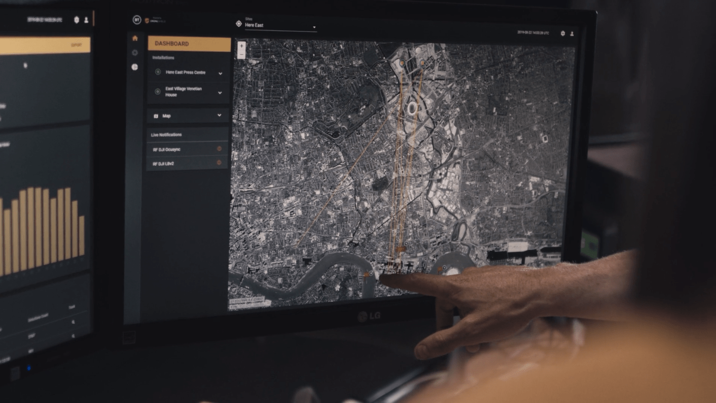
DroneSentry-C2 is a Command-and-Control (C2) system with an extensive reporting functionality, which includes a graphic user interface (GUI) that compiles and analyses vast amounts of environmental data to display to user seamlessly and effectively. This dramatically reduces reaction and response times.
The GUI harnesses the advantages of each detection technology, providing the user with an early warning system and growing detection threat level as more data is gathered and processed.
DroneSentry-C2 allows for remote access to DroneShield products to check statuses, configure system settings, monitor threat levels and respond in real-time. The convenient browser-based monitoring application lets you view and control your DroneShield detection and response activity from anywhere.
DroneSentry-C2 enables real time airspace awareness with a low cognitive burden to the system operator. It also acts as a Digital Twin, enabling virtual representation of the system’s physical sensor and effector assets, digitally overlayed to the required facilities, and providing simulation and training environment. It provides elements and dynamics of the system through its lifecycle to the end user.
BENEFITS OF DRONESENTRY-C2:
-
Scalable & Flexible - Platform is built to scale horizontally and vertically, on-premise or on AWS cloud. Can be used for single multi-sensor sites or several multi-sensor nodes working together.
-
Immediate Evidence Collection - Displays live UAS (e.g. drone) activity, providing alerts to the user about the environment, inbuilt tools for detailed, precise report generation.
-
Convenient - Can be accessed and configured remotely from a web browser, wherever there is Internet connectivity or as standalone desktop application. Air-gapped solutions also available. Alerts are configured through the GUI to send via SMS or Email for remote operators.
-
Compatible - RESTful API allows easy integration into existing security systems.
FEATURES OF DRONESENTRY-C2:
Manage the Site from Anywhere
Secure cloud-based processing allows operators to access their sites from anywhere, anytime.
Onsite or ‘air-gapped’ hardware solutions are also available.
Live Monitoring Dashboard
The Live Dashboard allows operators to observe and understand the drone activity around their site immediately. Vast amounts of environmental data is processed and distributed to the operator only when required, in a form that is easy to understand, enabling the operator to make critical and swift decisions.
Geofencing Zones of Control
Detection, disruption and exclusion zones can be set up within DroneSentry-C2 allowing the user to establish accurate protection of their facility.
Analytics & Detailed Evidence Collection
Stats and logs of drone intrusions are displayed in an easy to read format and can be exported for external use. Drone vendor, location, duration and MAC address are all displayed giving the user a clear insight into drone activity within their airspace.
User & Team Management
Manage your team members, notifications, permissions and activity with DroneShield’s built in User Management system.
Digital Twin Planning Tool
Embedded planning tool allows for rapid planning of new site deployments to assess performance capabilities and ensure operational success in a visual real-world mirrored simulation. Existing sites can be saved and replicated into the platform to capture system deployment scenarios over its lifecycle.
MIL-STD-2525 Compliant Mode
Available in a MIL-STD-2525 version with industry leading enterprise features and MIL-STD-2525 compliance. As a sensor agnostic, open architecture platform, DroneSentry-C2 brings advanced interoperability and flexibility to users.


BENEFITS OF DRONESENTRY-C2 DIGITAL TWIN:
-
Lifecycle Management - Model system deployment scenarios over the lifecycle of deployment
-
Pre-emptive - Allows planners, operators and users to pre-emptively discover and evaluate risks
-
Digital Footprint - Enables users to have a “copy” or digital footprint of their system through stages of its life cycle, from early proposal to physical deployment to maintenance
-
Rapid Planning - Reduces planning time for sensor layout and configuration from hours to minutes
-
Drag and Drop - Easy to use GUI streamlines setup workflow into simple drag, drop and select actions
-
Knowledge - Can be used as a communication and documentation tool to understand and explain behaviour of one or more systems
-
Continuous Improvement - Existing sites can be imported allowing operators to troubleshoot, make changes flexibly, assess and improve quality of their system
-
Collaboration Tool - Allows for import and export of secure files to be shared between operators
-
Built In - The Planning Tool comes embedded as standard with the DroneSentry-C2 software
FEATURES OF DRONESENTRY-C2 DIGITAL TWIN:
Integrated Knowledge
Combines predictive algorithms, AI, real-time & collected data from UAS threats, UAS behaviours, physical sensors, geographical environments, networks and processes into a library of knowledge for the intelligent, responsive and mirror-life simulation
Advanced Analysis
Simulate sensor performance, metrics and configurations such as range, accuracy and intersection performance quickly and easily
Comprehensive Parts List
Autogenerates the parts list required for the system design, including sensors, effectors, brackets and infrastructure
Geofence Critical Areas
Quickly apply zones to the Digital Twin site for the purposes of asset protection. These zones can be translated into Detection, Alerting and Auto-Disrupt zones via the DroneSentry-C2 GUI


